EXPLORATION
Hydrocarbon exploration (or oil and gas exploration) is the search by petroleum geologists and geophysicists for hydrocarbon deposits beneath the Earth’s surface, such as oil and natural gas. Oil and gas exploration are grouped under the science of petroleum geology.
Hydrocarbon exploration (or oil and gas exploration) is the search by petroleum geologists and geophysicists for hydrocarbon deposits beneath the Earth’s surface, such as oil and natural gas. Oil and gas exploration are grouped under the science of petroleum geology. Visible surface features such as oil seeps, natural gas seeps, pockmarks (underwater craters caused by escaping gas) provide basic evidence of hydrocarbon generation (be it shallow or deep in the Earth).
However, most exploration depends on highly sophisticated technology to detect and determine the extent of these deposits using exploration geophysics. Areas thought to contain hydrocarbons are initially subjected to a gravity survey, magnetic survey, passive seismic or regional seismic reflection surveys to detect large-scale features of the sub-surface geology.
Features of interest (known as leads) are subjected to more detailed seismic surveys which work on the principle of the time it takes for reflected sound waves to travel through matter (rock) of varying densities and using the process of depth conversion to create a profile of the substructure. Finally, when a prospect has been identified and evaluated and passes the oil company’s selection criteria, an exploration well is drilled in an attempt to conclusively determine the presence or absence of oil or gas.
Oil exploration is an expensive, high-risk operation. Offshore and remote area exploration is generally only undertaken by very large corporations or national governments. Typical shallow shelf oil wells (e.g. North Sea) cost US$10 – 30 million, while deep water wells can cost up to US$100 million plus. Hundreds of smaller companies search for onshore hydrocarbon deposits worldwide, with some wells costing as little as US $100,000.
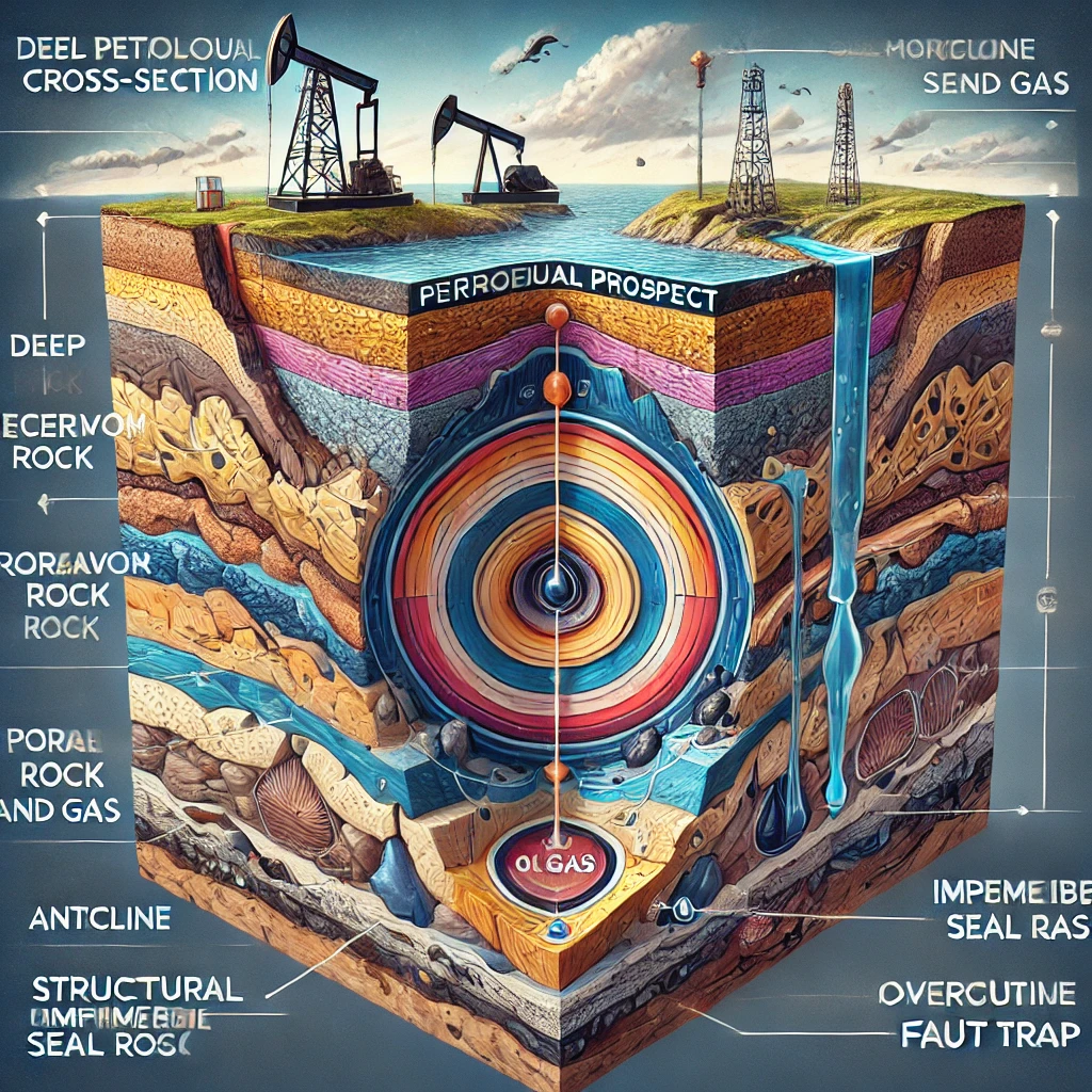
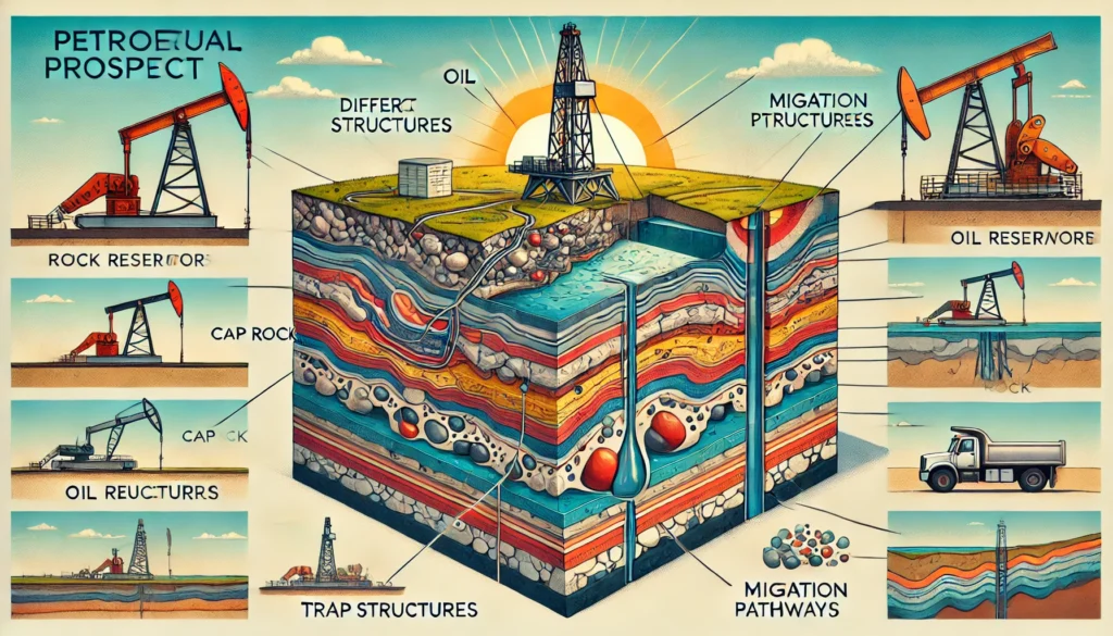
Elements of a petroleum prospect:-
A prospect is a potential trap which geologists believe may contain hydrocarbons. A significant amount of geological, structural and seismic investigation must first be completed to redefine the potential hydrocarbon drill location from a lead to a prospect. Four geological factors have to be present for a prospect to work and if any of them fail neither oil nor gas will be present.
- A source rock – When organic-rich rock such as oil shale or coal is subjected to high pressure and temperature over an extended period of time, hydrocarbons form.
- Migration – The hydrocarbons are expelled from source rock by three density-related mechanisms: the newly matured hydrocarbons are less dense than their precursors, which causes over-pressure; the hydrocarbons are lighter, and so migrate upwards due to buoyancy, and the fluids expand as further burial causes increased heating. Most hydrocarbons migrate to the surface as oil seeps, but some will get trapped.
- Reservoir – The hydrocarbons are contained in a reservoir rock. This is commonly a porous sandstone or limestone. The oil collects in the pores within the rock although open fractures within non-porous rocks (e.g. fractured granite) may also store hydrocarbons. The reservoir must also be permeable so that the hydrocarbons will flow to surface during production.
- Trap – The hydrocarbons are buoyant and have to be trapped within a structural (e.g. Anticline, fault block) or stratigraphic trap. The hydrocarbon trap has to be covered by an impermeable rock known as a seal or cap-rock in order to prevent hydrocarbons escaping to the surface
Hydrocarbon exploration is a high risk investment and risk assessment is paramount for successful project portfolio management. Exploration risk is a difficult concept and is usually defined by assigning confidence to the presence of the imperative geological factors, as discussed above. This confidence is based on data and/or models and is usually mapped on Common Risk Segment Maps (CRS Maps).
High confidence in the presence of imperative geological factors is usually coloured green and low confidence coloured red. Therefore, these maps are also called Traffic Light Maps, while the full procedure is often referred to as Play Fairway Analysis. The aim of such procedures is to force the geologist to objectively assess all different geological factors. Furthermore, it results in simple maps that can be understood by non-geologists and managers to base exploration decisions on.